Film
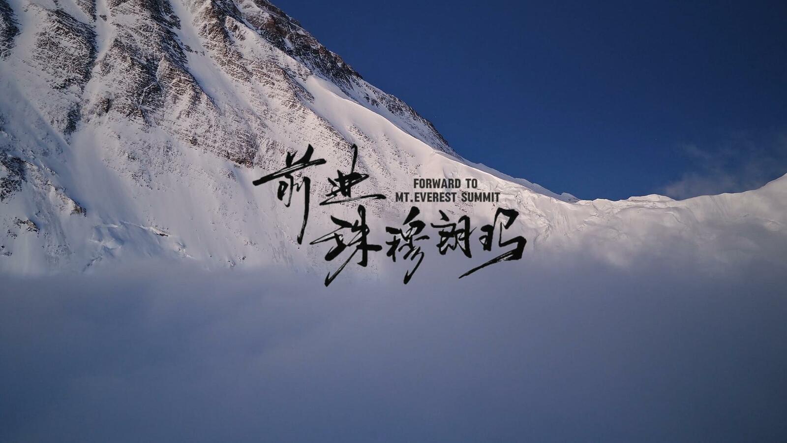
Forward to Mt.Everest Summit
About
Director
MACHUNLIN
Producer
MACHUNLIN
Sponsor
Pelliot, Surpine, Jack Wolfskin
Running time
5 minutes
Country / Nationality
China
Ma Chunlin is a Chinese photographer dedicated to capturing the landscapes of the Himalayas. In 2020, he collaborated with mountaineer Wang Jing to create a short film that introduced the summit route on the north side of Mount Everest in segments. During the process, he was deeply inspired by the stories shared by climbers and from that moment on, he aspired to film the entire climbing route in a continuous single shot. In 2021, he retraced George Mallory’s 1921 Everest exploration route, which was later featured as the cover story of *Chinese National Geographic*. This experience strengthened his resolve for the filming project, and he began meticulously studying shooting plans to showcase this legendary climbing route. After repeated calculations, he concluded that only the 6,500-meter camp on the north slope of Everest could serve as the starting point for the plan—the highest reachable point by trekking and the beginning of the climb. Starting in 2022, he attempted to access the area but was repeatedly halted due to various permit issues. In 2023, he was initially granted permission to enter the core zone but faced another setback due to unexpected circumstances. In 2024, he obtained last-minute approval but ultimately missed the climbing season. The arrival of the monsoon and strong winds caused the drone to fall short of the summit by just 400 meters. In 2025, during an extremely limited permitted period, he pushed himself relentlessly to seize the narrow window of opportunity. Enduring altitude sickness and bitter cold, he even pre-warmed the drone batteries against his own body to keep them functional. In the end, he finally succeeded. At the climax of the footage, a lone climber stood atop the world’s highest peak, framed against distant lightning and the breathtaking hues of sunrise, creating an astonishingly rare and sublime scene.
After descending, he edited the original 10-minute summit video with segmented speed adjustments to enhance the viewing experience. Collaborating with his friend Moss, he added an original score to this stunning landscape short film, which deeply moved countless mountaineers.Sustainability Notes:
In recent years, aerial photography has become a core tool for visual creation in the Himalayan region, yet its application is consistently accompanied by significant challenges. One of the most prominent risks stems from extreme and unpredictable weather, while the greatest environmental hazard arises from potential battery leakage pollution caused by drone crashes.
To address this, I proactively incorporate meteorological analysis into my workflow, using specialized software to study data and plan safe flight windows. During operations, I always keep the flight path on the recoverable side of the mountain. When sudden strong winds strike, I closely monitor the aircraft's attitude and make immediate adjustments‚ one of the key goals being to avoid crashes due to signal loss at all costs. This is not only about preventing equipment loss but also about protecting this pristine environment.
As for the waste generated during treks or climbs, I believe emphasizing its retrieval is unnecessary. It is not an option but a prerequisite. In my view, properly managing all waste is a fundamental part of the journey. Neglecting this would not only mean disrespecting the mountains but also foreshadow a lack of good fortune and the loss of opportunities to capture truly breathtaking moments.